
Page 67 - DGH_Annual_Report
P. 67
India's Sedimentary Basins: Subsurface Insights 67
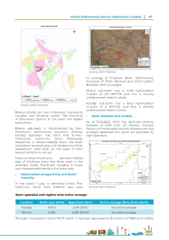
Source: DGH Internal
on analogy of Vindhyan Basin. Sedimentary
thickness of 270m (Bhima) and 3,000-4,500m
(Kaladgi) were envisaged.
Bhima sub-basin has a total hydrocarbon
in-place of 0.6 MMTOE and this is entirely
undiscovered risked in-place.
Kaladgi sub-basin has a total hydrocarbon
Source: DGH Internal
in-place of 6 MMTOE and this is entirely
undiscovered risked in-place.
Bhima-Kaladgi are two Proterozoic sub-basins
situated over Dharwar craton. The elements • Basin datasets and studies:
of petroleum system in the basin are largely
speculative. As of 31.03.2025, NDR has archived primary
datasets of 1,087 LKM 2D seismic. Multiple
Bhima sub-basin is characterized by Neo- flavours of reprocessed seismic datasets are also
Proterozoic sedimentary sequence whereas archived whenever the same are provided by
Kaladgi sub-basin has thick Pale to-Neo- E&P Operators.
Proterozoic sediments. Entire Proterozoic
sequences in Bhima-Kaladgi Basin has been
considered as single play, sub-divided into three
assessment units each on the basis of their
respective tectonic set-up.
Paleo-to-Meso-Proterozoic Basuhari-Rohtas
play of Vindhyan Basin has been used in the
analogue study. Sub-basalt imaging to study
sub-trappean sediments is the focus area.
• Hydrocarbon prospectivity and Basin
maturity:
In the basin, 1 play is identified within Pre-
Cambrian. Aerial Yield method was used Source: DGH Internal
Basin appraisal and regime-wise active acreage:
Location Basin area (skm) Appraised (skm) Active acreage [Nos./Area (skm)]
Kaladgi 8,820 2,616 (30%) No active acreage
Bhima 5,280 5,280 (100%) No active acreage
The basin occupies an area of 14,101 sq km. It has been appraised to the extent of 7,896 sq km (56%)