
Page 54 - DGH_Annual_Report
P. 54
54 INDIA'S HYDROCARBON OUTLOOK 2024-2025
• Basin datasets and studies: archived whenever the same are provided by
E&P Operators.
As of 31.03.2025, NDR has archived primary
datasets of 1,488 LKM 2D seismic and 2 The basin has 2 coal-seam gas wells (all
conventional wells (all exploratory). Multiple exploratory).
flavour of reprocessed seismic datasets are also
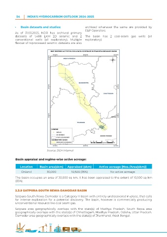
Source: DGH Internal
Basin appraisal and regime-wise active acreage:
Location Basin area(skm) Appraised (skm) Active acreage [Nos./Area(skm)]
Onland 30,000 10,500 (35%) No active acreage
The basin occupies an area of 30,000 sq km. It has been appraised to the extent of 10,500 sq km
(35%).
2.3.9 SATPURA-SOUTH REWA-DAMODAR BASIN
Satpura-South Rewa-Damodar is a Category III basin with entirely undiscovered in-place, that calls
for intense exploration for a potential discovery. The basin, however is commercially producing
unconventional resource like coal seam gas.
Satpura area geographically overlaps with the state(s) of Madhya Pradesh. South Rewa area
geographically overlaps with the state(s) of Chhattisgarh, Madhya Pradesh, Odisha, Uttar Pradesh.
Damodar area geographically overlaps with the state(s) of Jharkhand, West Bengal.